Sunday, 15 October 2017

Faea Blong Bigfala Hill: Exploring Vanuatu, Part 1


When in Lamen Bay, on the island of Epi in Vanuatu, you can be forgiven for thinking that the sun sets in the north. When the day fades into the western ocean and dusk deepens, the volcano of Ambrym appears as a red beacon, illuminating the underside of clouds that hover almost permanently above its caldera.

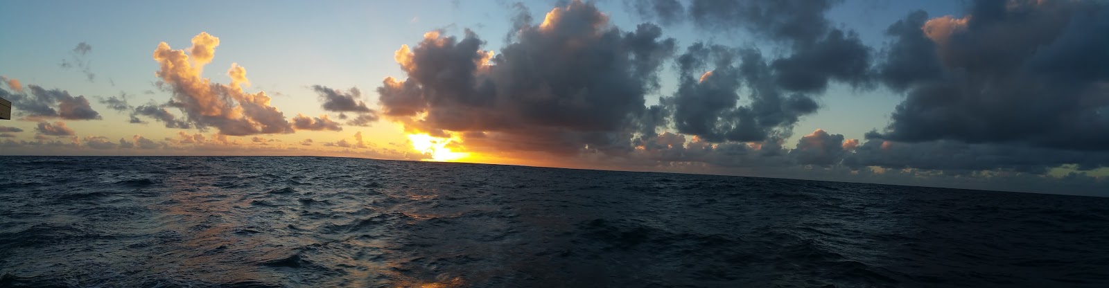
Once our trusty crew departed after the crossing from Brisbane to Noumea, George and I quickly found a weather window for the 350 odd nautical mile trip to Port Vila. Eighteen to 20 knot sou-easters right on the beam, seas less than 1.5 metres and coming from behind. We put a reef in the mainsail, pulled out the genoa and, at 9 knots, travelled over 200 miles in a single day. This was our first overnight passage as a team of two, and we did 3 hour shifts around the clock. Although the seas were slight, it was my first introduction to the south pacific "slop" where differently oriented swells compete with strong ocean currents and the sea is then whipped by the wind to an uncomfortable state resembling the agitate cycle in a washing machine. You can see this in the photograph above.

Our track from New Caledonia to Port Vila (Efate), and then to the northern islands of Epi, Malekula, Ambrym, Santo and Ambae.
The slop seems to arise from the confounding influences of mountainous islands, strong trade winds, and the fact that the oceanic fault lines of the Pacific's Ring of Fire run straight through Vanuatu. If you ever wanted proof that wind, tide and geography interact with one another, come spend a day or two beating through the end-result!

Satellite image showing the submarine fault lines running through the Vanuatu island chain. The islands are simply the peaks of current or past volcanoes jutting from the surface of the ocean.
Now, upon entering Vanuatu one of the first things one must do is get used to reading a foreign language. Many Vanuatu people speak English, some speak French, but Bislama is pretty much universal, even though Vanuatu has over 100 dialects (the highest per capita in the world, and second only to New Guinea). Bislama is a form of pidgin English that is surprisingly easy to understand once you've got over the fact that many of the words do not appear in the Oxford Dictionary. Back to the title of this blog; Faea blong bigfella hill. Say it out loud and you will realise it says "fire belonging to bigfella (large) hill". Mountain fire. That is, an erupting volcano. The term bigfella is quite versatile. George ordered a bigfella hamburger in Santo and what arrived was surely designed to turn a man into a bigfella if he was not already.

So this is the stori of the taem Geraldine and man blong Geraldine (ie, George) sailed hemi waet sip, Alchemy 1, (really just a bigfella bot) to Port Vila and beyond.


 After we arrived and cleared customs, we took a mooring at "Yachting World", which allowed us a good night's sleep and access to shore for some important things like a welcome drink (Tusker Beer), and a visit to "Vila Distributions" which had the best range in French wine this side of the International date line.


Thus provisioned, we felt confident to set off for the northern islands. Our first stop was Port Havannah, where we were reminded that the insurance companies want you out of Vanuatu by late November for a reason, and even super-yachts are not immune to a cyclone like Yasi, Pam or Donna.

Wrecked superyacht "Blue". The insurance company is not able (interested?) to find a way to lift if off the reef and refloat it after it was driven aground by a cyclone.
 This was the first of many wrecks we saw in Vanuatu, a sobering reminder that boats and reefs do not mix well, and even worse when a strong wind is blowing.

Wrecks, soon-to-be-wrecks and ferries cohabit this jetty on the island of Malekula.
George first visited this hulk in the early 1980's when it was still salvageable. Time, sun and salt water have done their thing (to all of us actually) and she is no longer the ship she was.
The other thing we were to discover was that the nautical charts, while highly accurate in New Caledonia and studiously overcautious in Australia, were up to 100 metres out in Vanuatu. The island below had a sneaky little reef projecting from its western shore that is quite obvious on a Google Earth image, but doesn't rate a mention on the charts.


Once we changed course to avoid running aground, we found it was a nice little reef, where we had a pleasant dive and George speared the only fish of the trip; a fat coral trout. This island was uninhabited, which had presumably spared the surrounding ocean and its fish population.


We were sad to find that most of the reefs and waters of Vanuatu are seriously over-fished. The villagers are making a living from the sea and from the land, but an increase in population and pressure from illegal fishing by the Chinese amongst others means that the catch is diminishing; and instead of mackerel and coral trout, the locals are forced to eat butterfly fish and the other small species that survive when apex predators disappear.

From Vila, we sailed north to Port Havannah, a quiet and sheltered anchorage at the head of a long bay. There we had our first encounters with the locals (Ni-Vanuatu) who were very welcoming and keen to trade fruit and vegetables for luxuries like batteries, long-life milk and sunglasses.


The grapefruit (pumplemousse) were huge, with sweet red flesh, the coconuts were young and tender and made great coconut milk. Likewise, the bananas were very tasty and magically did not all ripen at once.

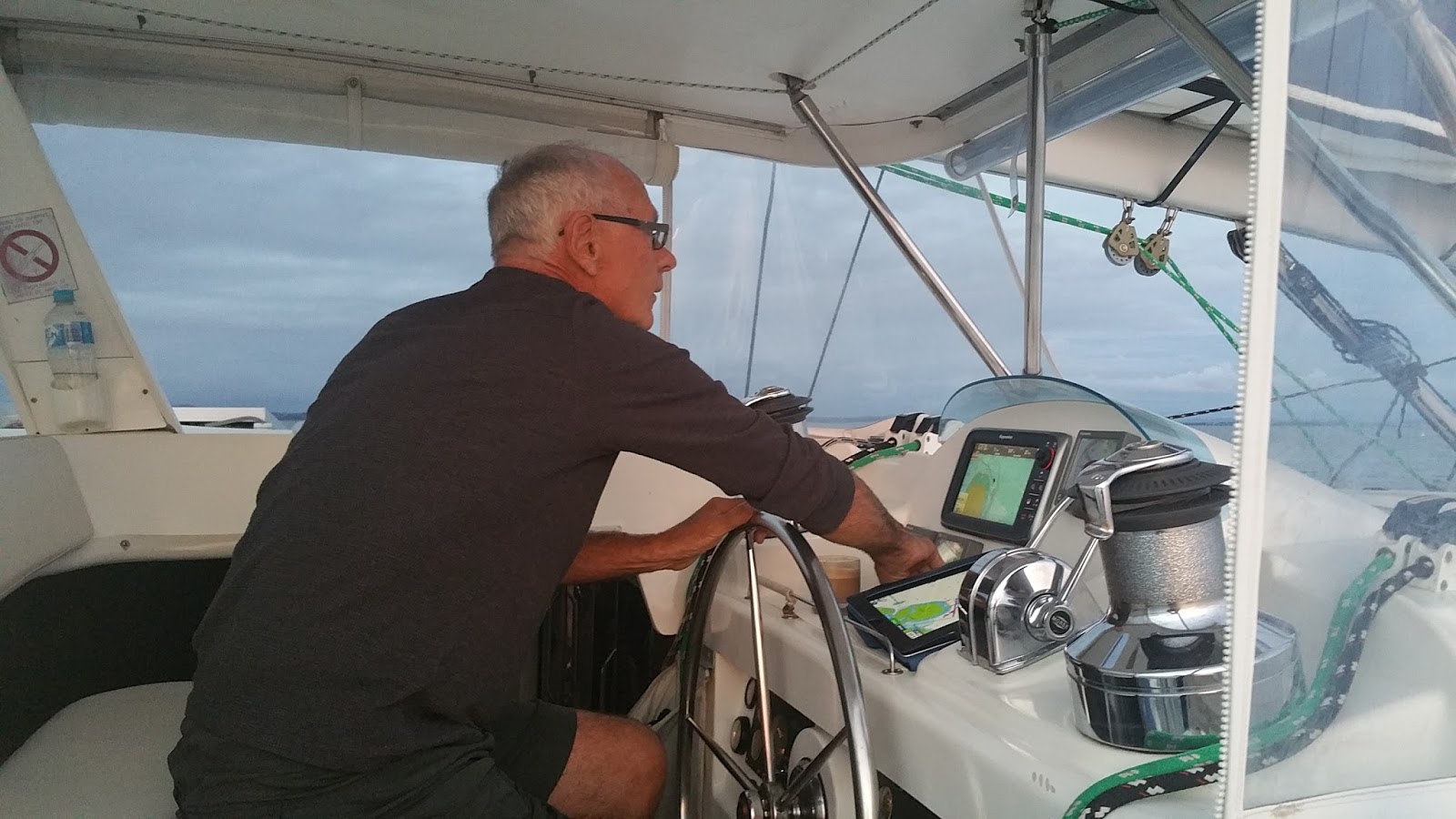
Captain George writing the daily log.

We went ashore one afternoon and met Kennet (the "h" is silent in Bislama). Kennet needed help with his outboard engine, and all of a sudden George had a project!

The project ended up taking two days, during which time George learned a lot more about Kennet and his family, and decided to donate a tool kit to the village, so Kennet could learn more about engine mechanics and they could do their own repairs in the future. There was great interest as George unveiled the tool kit.
 

Kennet's uncle was an officer with Port Vila immigration, and helped fast-track our clearance from the country when the time came to return to Noumea.

From Port Havannah it was north again to Lamen Bay, an idyllic anchorage that we had completely to ourselves for our first visit.


At Lamen Bay, I sighted my first dugong, feeding on the sea grass at the southern end of the bay. The dugong is protected in Vanuatu and recognised as an important tourist attraction. It is hard to get photos of them as they only surface intermittently and take a couple of breaths, before diving again. They do, however, flick their tail up in the air as they dive (their tail is very like a dolphin's), which is the time they are most likely to be sighted.

Welcome sign celebrating the local marine life at Lamen Bay Airport.


The main welcoming committee when we sailed into Lamen Bay were the resident pod of spinner dolphins, who showed us to our anchorage and entertained us for three days as they fed and played in the lagoon. 
Add caption
The spinner dolphins like speed and are not scared of boat engines. I lured them to the dinghy by revving the engine and they repaid me by escorting me back to Alchemy 1.
This timelapse photo (https://thehound2.files.wordpress.com/2015/04/spinner-dolphins.jpg) captures something I could not; the amazing aerobatics of this engaging little dophin.
 We returned again to Lamen Bay at the end of the trip, but by then the cruising season was in full force and with 6 yachts anchored in the bay there was no sign of either the dugongs or the dolphins.

To Be Continued

Monday, 7 August 2017

The Crossing: Brisbane to Noumea


In June, the annual yaching migration was in full force. We watched our friends depart Manly, QLD for exotic locations. Boats lined up to cross the Wide Bay Bar for the journey to the Whitsundays and beyond. The "Go East" Rally left Southport; a flotilla of 20 plus yachts heading for New Caledonia and Vanuatu. 
      Alchemy 1, too, was finally heading offshore after her extensive refit and shake-down voyages. Her bow sprit had been repaired after the Lord Howe Island mishap. It would take the better part of five days to reach New Caledonia and our departure was dependent, almost entirely, on the weather. 
     Our crew for the voyage to Noumea (Bill and Simon) were on-call, waiting for news that a weather-window was opening.
     We needed a rather particular type of weather. Catamaran cruising is all about sailing downwind - or at least trying to avoid sailing into a wind that is less than 60 degrees off the bow. Not only are catamarans not designed for sailing close to the wind, but it usually means you are also sailing directly into the swell, which can be most uncomfortable. So we were looking for a weather pattern that would give us a wind direction on the beam (side) or aft (behind), not too much wind so we would not have to worry about the sails being overpowered, and hopefully also a swell that wasn't too huge.

 Here you can see a sailable wind angle (but a little too much wind for full sail). Alchemy can sail very well at this angle, but it can be a rough ride into the swell.
 Here we have a perfect wind strength (15.2 knots) but a wind angle that's on the nose, making for uncomfortable cruising conditions.


Here is a much better wind angle, from our trip to Great Keppell Island, but our ideal is at least 15 to 20 knots on the beam (90 degrees), at which stage we can sail around 9.5 to 10 knots very comfortably, and faster if the sea is calm.

So, how to achieve these conditions? There are two main weather patterns that influence wind on the seas between Brisbane and Noumea; the low pressure system and the high pressure system.  In the southern hemisphere, air circles clockwise around a low pressure system and anti-clockwise around the high.

Synoptic chart showing a low pressure system and a high pressure system side by side. You can see from the arrows that the winds are circulating in different directions (RCGroups.com).

Satellite photograph of a clockwise low pressure system (NASA).


A low pressure system has (by definition) a low pressure core that sucks wind into its center and sends it skywards (which also creates clouds and often rain). As the core pressure within the system drops lower and lower it intensifies (as does the wind strength) until it becomes a cyclone. 


A high pressure system is also called an  anti-cyclone, because the winds rotate the other way. You can imagine that if you planned to sail your catamaran to Noumea, you would either want a high-pressure system that hung around for 5 days, delivering a nice southerly or sou-easter, or a low pressure system that would sweep you across the top as it moved east.
     Low pressure systems are a bit like colds - you never know quite how bad it's going to get, which is why a high is usually preferable to a low. We got the low. Not as intense as this one below, but one that looked quite like it. It was forecast to move slowly towards New Zealand without ever getting too strong or scary, giving us following winds (and more importantly following seas) for the whole trip, but who knew how fast it would move or in what direction, or whether it would intensify?


We use a weather forecasting system called Predictwind, which creates colour-coded charts to tell us what the wind and swell is likely to be doing at different times during our trip. We can also tell it when we plan to leave, what our boat speed is, and what conditions we would like to avoid (40 knot winds, 4 metre seas) and it will plot a course for us.


 This a GRIB file that shows wind arrows and also a colour-coded chart of wind speeds. The arrow points in the direction the wind is going, and the number of barbs indicate the wind strength. One barb is 10 knots, 2 barbs 20 knots, etc. We were looking at a following wind of 15 to 20 knots. Perfect. Now for the swell.


This chart shows swell direction, with a colour-coded map of swell height. It is simple; purple and blue good, red bad. The big red splotch (5 metres or 16 feet) in the center of the low pressure system was forecast to intensify in the south, but spread north as the low travelled east. We should have swells less than 3 metres if we made good time, but if we hung around in the middle of the ocean for a day or so longer than we needed to, the red splotch would catch us up. But Alchemy 1 is fast and as long as we kept moving at 7.5 knots or better, we would be able to stay ahead of the sea. The decision was made; this was our weather window for better or for worse; and Bill and Simon booked their flights.

Because it is always good to get a second opinion, we engaged a legendary weather forecaster and sailor from New Zealand, "Met Bob", to prepare a voyage forecast for us. He suggested we start a day earlier (to stay ahead of the sea) and track further north to avoid strong winds, high seas and also make use of a current flowing between two seamounts. He sent us a chart that included a recommended track, GPS waypoints and compass bearings for the different legs of the journey.

Our individualised voyage forecast from Met Bob. It shows a recommended track (GPS waypoints in blue and red), with compass headings and distances, and the conditions we can expect at different times during the journey. The black lines are isobars, you can see the wind barbs which are colour-coded (from blue to red). The pale purple lines are swell heights. We tracked north to avoid the 4 metre swell line.
Two Australian Customs officers came to the boat in Manly, QLD on a Friday afternoon to check us out, we anchored offshore that night, and at first light the next day, we were on our way.


Because we were heading north for the first two and a half days, we set course for the top of Moreton Island, and then out to sea.


Predictwind, and our satellite phone system, Iridium-GO!, team together to offer an automated tracking system that allows family and friends to see where we are. There are no secrets ...


The Australian coast slipped behind us, and we were at sea. We organised 2-hour watches throughout the day and night; with 4 crew that meant we had 2 hours on and 6 hours off, very workable, and we kept the same watches for the whole 5 days to allow us to get into some form of routine. We had lunch and dinner together but organised morning coffee and breakfast around our individual schedules. The first day was easy; very little swell, but sadly very little wind either. Leaving a day early meant we had to wait for the low pressure system to catch us up. The sea was calm but getting a little lumpier as the sun sank slowly in the west.


Dawn the next morning brought a little more swell, and a lot more wind.


 We put our sails up but fairly quickly had to reef the main as the wind rose to 25 knots. It was a little un-nerving, because we weren't sailing all that fast (only about 6.5 knots as the red dot will have testified to anyone who was watching), and we knew the low pressure system was marching inexorably up behind us. We trimmed our sails and waited for the conditions to intensify ...

But they did not. Our northerly track (recommended by Met Bob) kept us away from the heavier weather.


My favourites are the night watches. You have the boat to yourself while your crew mates sleep (or try to sleep below). There is no light apart from the stars and moon, and the glow from your instrument panels. You put your ear plugs in and choose the most atmospheric album from your playlist. On this night, with the full moon rising and laying a silver path to the horizon, it was Jeff Wayne's "War of the Worlds".


The instrument panel at night. You can see a favourable wind (about 100 degrees), an autopilot compass heading of 40 degrees (north east), the glow of the red and green navigation lights on the bowsprit above the screen to the top left of the picture and, although you need faith and determination to see it, the glow of the full moon on the sea ahead above the middle of the screen.
By day 3, everyone was settling in to their routine. Nothing (and nobody) was broken and we rotated through our watches, read books, caught a couple of hours sleep when we could (by now we were motor-sailing to keep our speed up so we alternated engines so the person off-watch had a little less noise coming through their bunk). In the late afternoon of the third day, we reached the waypoint between the Argo seamounts and made our turn to the east.

 
Sunset saw us pick up speed as we were swept along with the easterly current, as indicated by the red arrow on this image from Windy TY Website.


The next day, the swell was directly behind us and pushed us along. Every so often a larger wave would pick us up and we surfed down the front. You could feel the boat accelerate; it was exhilerating. The wind dropped (perhaps we had gone too far north to avoid the swell). It was also coming from almost directly behind, so the large mainsail was not very useful as it shielded the headsails. We tried various sets, including "goose-winging" where you put the two headsails out on different sides.


Sometimes "Goose-winging" requires a human pole - but only when the conditions are very calm!


Our mascot, Jack Tar, gets to know Simon's monkeys, who had made this trip 36 years ago.
Bill having his morning tea.
Always time for a quick repair job. In this case, our 110 volt battery charger.
And on the fifth day, the wind dropped out, the gentle swell rolled in from behind, helping us along, and with Noumea almost in sight we simply enjoyed the day. We put out a fishing line and skirted rain showers.


Before too long the fishing rod paid off and Simon had hauled in a nice Wahoo.


George filleted it, we rolled it in breadcrumbs and pan-fried it, David Beer-style, and sat down to the freshest lunch possible. We weren't quite finished when the fishing line sprang taut again. What did we have this time?


Simon began the hard work of hauling in what was clearly a large fighting fish on a hand line. 


 But it was worth it. A Mahi Mahi!


What a fabulous fighting fish it was. And supposedly such good eating. 

It was hard to imagine, after the excitement of the fish, what else the ocean had in store for us, but it was not too long before we were joined by a pod of whales. Not the lumbering, flopping and slapping humpbacks, but sleek, fast whales that tracked along effortlessly next to us even though we were doing eight knots. Fin whales, or possibly Minkes. They were beside us and behind us and for a short while two of them actually swam under our back scoops, looking up at us and showing their fluorescent white bellies. Impossible to get a decent photograph, although we tried and have videos to prove it. Everyone was elated by this visitation from the deep.


It could be any sort of sea monster, but this blurred shape is the whale that rode in our following swell.
Noumea grew closer and eventually the mountains of Grand Terre rose from the horizon. We hoisted the yellow quarantine flag, and the courtesy tricoleur, and flew the Aussie flag out the back.


We would not enter the lagoon until many hours later, after the sun had set, but the end of our voyage was in sight. 

 Thanks to some favourable weather, the smooth performance of the boat, and the help of our fabulous crew, we had arrived.