John and Pam arrived in New Caledonia on the night of the Noumea Carnival; a vibrant and loud (very loud) annual event. After a quick dinner aboard Alchemy 1 we were unable to resist the sounds of celebration and wandered the short distance into town from the Port Moselle Marina to join in. The streets radiated a cultural rainbow of people, costumes and lights, as the parade gyrated its way past the Place de Cocotiers (Coconut Park). According to the 2014 New Caledonia census, 37% of New Caledonians are Kanak (indigenous people of Melanesian descent) and 27% are European. A further 8% of people identified as "Caledonians"; a term for European people who were born there. The rest are a mix of South Pacific Islanders, with a very small population (less than 3%) of Chinese and Indonesians. This rich ethnic mix was fully evident in the street parade, and the night had a comforting (and somewhat unexpected) aura of harmony and fun as Noumea's inhabitants celebrated "New Caledonia Day".
Parque de Cocotiers on a much quieter, sunny morning.
Later, when I did more research, I was interested to discover that New Caledonia Day marks its establishment, in 1853, as a French Overseas Territory. The Carnival was happy and peaceful, but New Caledonia's history has not always been that way.
After the parade, Alchemy 1 provided a front-row seat for the fireworks display. A fitting end to the celebration considering New Caledonia's sometimes explosive past.
Aerial view of Port Moselle with Noumea in the foreground. Noumea is a sailing mecca for locals and overseas visitors like ourselves. Photo from Getty Images.
Peak hour in Noumea. Many of New Caledonia's visitors come by sea.
John and Pam joined us for 3 weeks, during which time we explored many of New Caledonia's bays and islands, and learned much more about its cultural, historical and natural heritage.They provided many of the photographs and videos in this blog post, and knew their way around the boat after last year's cruise with us.
Alchemy 1's tracks from Noumea to the Isle of Pines, Ouvea, Beautemps-Beaupre and down the South-Eastern shore of Grand Terre.
Lighthouses of New Caledonia
As I showed in the last blog post, New Caledonia boasts many coral lagoons, and Noumea is situated on one of the largest.
Looking across the lagoon toward Noumea.
Being such an important shipping channel, the lagoon has several well-charted entrances, the first and best-known of which (Boulari Pass) is marked by Phare Amedee.
Geraldine and Pam at Ilot Amedee.
Amedee Lighthouse was commissioned in 1861 in response to several shipwrecks. The first iron lighthouse to be built in France, it was erected outside the Eiffel Tower engineer's workshop in Paris, then dismantled and the 1265 pieces (388 tonnes) shipped to New Caledonia. It lit up in 1865 and has since welcomed many seafarers to Noumea. It's nominal range is 20 miles, and when we first approached Noumea at night, we were comforted to see it appear on the horizon. The interior of the lighthouse is artistic in its own right, and provides a great opportunity for some exercise to make up for all those sundowners and nibbles on the boat. Climbing the 247 step spiral staircase posed an unexpected challenge for us boat people, with our wobbly land legs, as the whole structure seemed to be swaying.
Made it!
After leaving Noumea we headed south, through the Woodin Canal, and moored in Anse Majic (which truly was a magic bay) in the Bay de Prony, and hiked to the top of the N'Doua Nature Reserve.
Rich red soil and dense vegetation of Anse Majic.
Looking south across the Woodin Canal. If you sail right you go to Noumea, if you sail left, you go out to the Pacific. The Woodin Canal is the route by which virtually all vessels travelling east to west via New Caledonia will enter the great lagoon.
Pam looking out to sea from the base of the lighthouse. The Bay de Prony and Anse Majic are in the background and, although you can't see it, Alchemy 1 is moored behind the brown hill.
George and John climbed the security fence with the Access Interdit sign (who knows what that means, anyway?) to conquer Phare N'Doua.
Looking north east at Havannah Pass. This is the entrance that most vessels approaching from the east take to enter the great lagoon. The red-roofed structure is a whale-watching lookout with educational information about the area's natural history.
Coming through Havannah Pass is an exciting experience and should be timed carefully as the current is very strong. Here we are doing 12.4 knots under motor, having picked up around 5 knots with the incoming tide.
The Isle of Pines
From Bay de Prony we tracked south, to the Isle of Pines, and another very interesting part of New Caledonia's history.
High speed ferry coming through the Woodin canal on its way to Bai de Kuto, Isle of Pines.
Happy about shore leave in Bai de Kuto.
After being seen (but not explored) by Captain Cook, who named it, the
Isle of Pines became a penal colony in 1864, housing 21,000 political
prisoners over 33 years. Now the old buildings are being reclaimed by
the land.
Another goal of our visit to Kuto was to visit the local bakery and indulge in that other cultural imperative; the crusty French baguette.
George proved a willing porter and we managed
to get them back to the boat despite a minor disaster just after this next photo was taken when the dinghy
was swamped as we were pushing off from the beach.
But the day was saved when Pam suggested re-baking them atop the solar panels to restore their crustiness.
Typical lunch with baguettes and French cheese and one of the many reasons that plenty of exercise is also required.
Not to forget, a gourmet dinner every night!
Our next stop was Ilot Moro, where we went for our first dive.
Then on to Gadji, where we were treated to a spectacular sunset.
Sunset at Gadji and a view of those versatile solar panels.
Our next stop, Bay de Oro, was somewhat tricky to navigate, but enchanting.
It had some good examples of the strangely eroded reefs common around the
Isle of Pines; that remind me of the floating islands of Pandora,
for anyone who has seen the movie, Avatar.
We also hiked to a protected tidal bath (called The Natural Pool) and swam in water safely free of sharks but not, sadly, of other tourists.
Ouvea
After a quick trip back to Noumea to restock our photographic equipment, we headed again to the Woodin Canal but this time we kept going, doing Pam's first over-nighter to Ouvea.
Action photo of the two brothers at the mast.
Our destination was St Joseph, a village at the northern end of the lagoon, where we would go ashore and perform the Coutume ceremony to ask permission from the Chief to visit the atoll of Beautemps-Beaupre.
St Joseph, dominated by the Catholic Church steeple.
Ouvea has a complex history, being at once a welcoming place frequented by tourists, and a center of political unrest with occasional violent outbursts. In 1988, 4 gendarmes were killed and 27 taken hostage by Kanaks sympathetic with the Socialist National Liberation Front. When French security forces intervened, eighteen Kanaks and two more gendarmes were killed. The people of Ouvea and the other Loyalty Islands (Lifou and Mare) are independent and do not necessarily welcome "Francophile" tourists, so it pays to tread carefully. Nonetheless, when we came into the beach we were welcomed by a guide organised by our Noumea friend, Jose, who took us to meet the Chief (actually we met the Chief's wife and other relatives) to perform the Coutume ceremony.
Traditional Kanak structures in St Joseph.
La coutume (custom) is a way of showing respect to the people who own the region you wish to visit. A gift is brought and permission is asked to go ashore, swim, fish, hike and take photographs. Jose advised us that a bolt of cloth, a packet of tobacco and a 5000 Pacific franc note would seal the deal. In reality, it did feel rather as if we were simply paying to go to Beautemps-Beaupre, but we liked having a formal process to show our respect and gratitude and we felt more like legitimate guests later, when the local owners motored past our anchorage at the atoll.
Beautemps-Beaupre
Then it was on to what I consider the highlight of our 2017 cruising season. Named after a French hydrographer, hydrographic engineer and cartographer, this attol is a nesting site for seabirds and also a turtle hatchery.
We were able to go ashore for some limited hiking, but the best feature was the water clarity in the shallow lagoon, allowing us to see the bottom even at night.
We went spotlighting one evening for marine life and ended up attracting more than we bargained for!
Once we got into the water, the diving was spectacular, with great visibility.
And then there were the birds and the sea turtles, as you can see from this series of short videos.
These
were green turtles. I also saw a loggerhead lying on the bottom around
20 feet down, but all I managed was a video of my left ear, for a reason
that still eludes me. After three perfect days the weather forecast forced us to head back to the mainland. We left Beautemps reluctantly, but the adventure was not yet finished.
South-East Coast of Grand Terre
Most people know about the west, and Noumea with its lagoons and islands, but fewer people visit the anchorages and towns of the east coast. Because the southerly wind picked up, we had to do short hops down the coast, leaving at dawn when the seas were dampened by katabatic winds caused by cold air dropping from the high mountain peaks early in the morning.
Thanks to Pam for this photo of Alchemy 1 at anchor in one of the bays on the eastern side of Grand Terre. It shows the mountainous terrain on this side of the island, that has great influence on the wind. It is probably the reason this island reminded Captain Cook of Scotland (called Caledonia by the Romans).
The moment we reached the east coast of Grand Terre, we were greeted by another natural phenomenon; the annual shearwater migration. Millions of these birds fly thousands of kilometres, and many of them track down the east coast of New Caledonia. We sailed right through the migration, birds streaming effortlessly to either side as we approached our anchorage.
John is capturing flight shots, but a video might show this extraordinary event even better.
It took us a few days to get back to Noumea, and it was not all plain sailing, but we found time to relax nonetheless.
John did an excellent job ensuring the wine supplies lasted until the end of the trip. Not an easy task!
Back to civilisation.
And so we reached the end of a wonderful three weeks with fantastic travelling companions.
Clownfish in an anemone growing in a spherical coral outcrop in New Caledonia.
In 2008, the lagoons of New Caledonia were added to the UNESCO World Heritage Site list. New Caledonia is the second longest example of a double-barrier reef in the world. The reef is 1500 km long, and encloses a lagoon that is 24,000 square kilometres in area. We recently explored a very small fraction of it.
Predictwind image showing Alchemy 1's tracks around the lagoons surrounding Grand Terre (Noumea), Ouvea and Beautemps, the southern lagoon, and Isle de Pins.
Coral reefs exist in oceans less than 50 metres deep, and grow up to the high water mark. Reef-building coral polyps establish colonies on base rock that is either flooded by rising sea levels (as happened with Australia's Great Barrier Reef), or has projected upwards as a result of volcanic activity or tectonic plate shifts. The coral polyps form skeletons of calcium carbonate, that combines with other minerals to form a substance called aragonite, making the coral outcrops hard and sharp. The New Caledonian reefs are noted for their diversity.
Coral diversity at Isle of Pines.
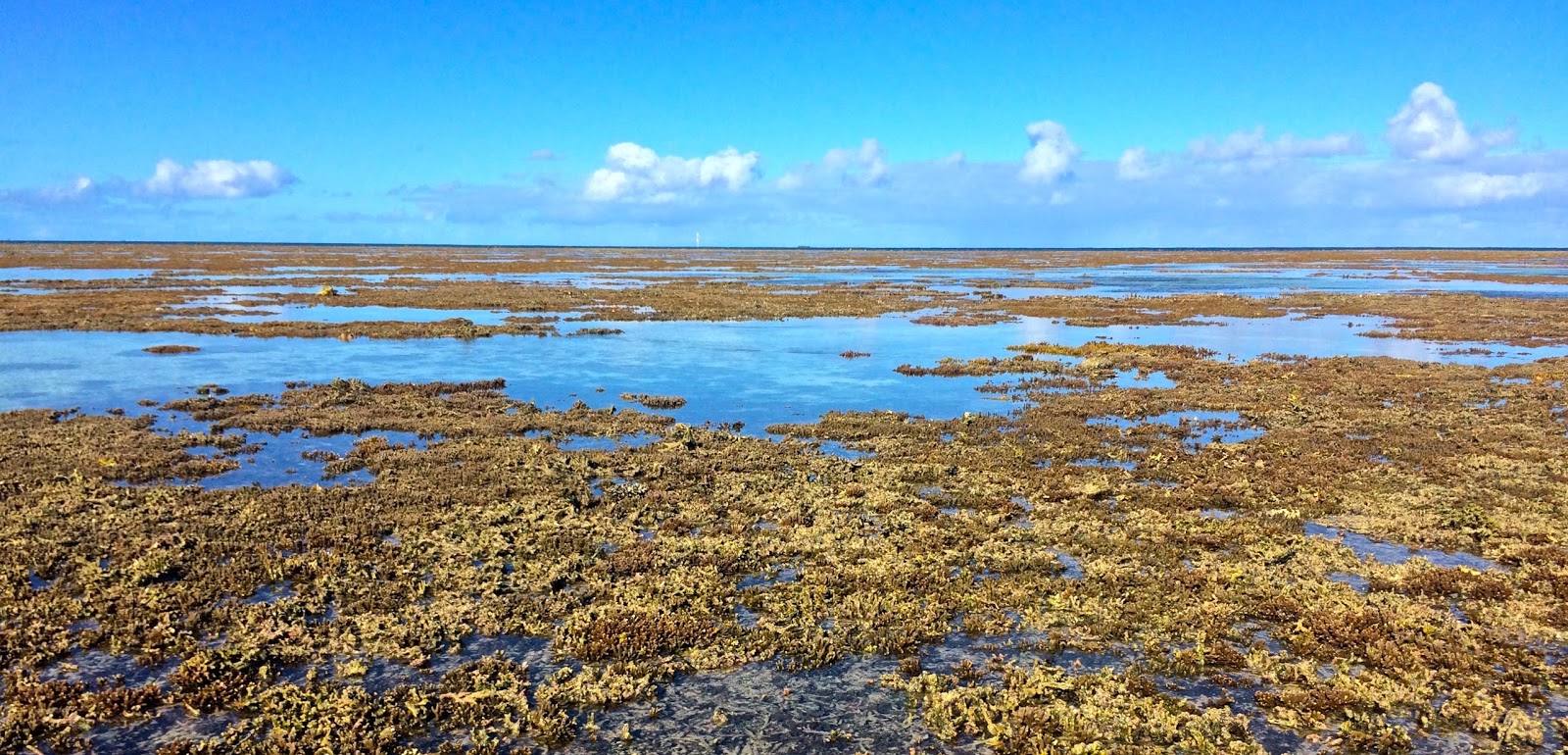
Low tide exposes the coral reef at Ilot Amadee.
Alchemy 1 on a mooring laid by the Parks Service to protect the coral at Ilot Amedee.
Alchemy 1 viewed from the top of Amedee Lighthouse. You can see the fringing reef projecting outwards from the island.
Image from the Rocket Cruising Guide to New Caledonia (http://www.rocket-guides.com/new-caledonia-cruising-guide.html), showing the extensive reef system around the Isle of Pines.
Not surprisingly, with all this coral and all these reefs (aragonite is much harder than fiberglass), navigation can be quite hazardous. Fortunately the navigation charts are very accurate in New Caledonia, and we had an excellent interactive program called the Rocket Guide, that provided detailed information about anchorages, waypoints and aerial photographs to help find our way into some of the trickier lagoons.
Rocket guide information on how to enter the Ilot Moro anchorage.
Even the best charts and photographs cannot replace the tried and true method of standing on the bow (or up the mast) and looking where you are going. The best conditions are when the sun is out, high on the sky (ie not in your eyes) and there is a gentle wind ripple on the surface so the sea is not like a mirror.
Here we are following some cruising friends, Gerald and Katrin, in their Beneteau 49, as they guide us to one of their favourite anchorages. These are perfect cruising conditions and you can see the distinct colour change as we approach the reef.
We only had time for a short trip to the southern lagoon, but were rewarded with some beautiful weather and productive spearfishing!
George speared this impressive coral trout. We then handed it to Katrin who prepared a French feast for five.
We found the pick of the diving, though, at the island of Beautemps-Beaupre, which we visited with John and Pam. Beautemps-Beaupre is a satellite island from the huge atoll surrounding the island of Ouvea, a day's sail to the north of Grand Terre.
Alchemy 1's tracks to Ouvea; one of the Loyalty Islands to the north of Noumea.
This satellite photograph shows the huge lagoon of Ouvea, and our track to and from Beautemps-Beapre, in the top left.
Beautemps-Beaupre is a nature reserve, home to nesting seabirds and mating turtles when we were there. The anchorage was in a protected lagoon next to the small island, with a white sand bottom and our own private beach.
The water was pristine, and the visibility for diving spectacular.
John and Pam looking very much at home in the clear water.
We weren't the only ones there, of course.
For some reason, New Caledonia is home to huge numbers of sea snakes. They are called tricot raye, or "stripey sweaters" and are equally at home on land as in the water. They are curious and not intimidated by selfie-taking tourists.
Simon does his "Steve Irwin" impersonation after he helped us bring the boat to Noumea. "Crikey!"
We found this tricot raye climbing aboard our back scoops one night, attracted by our stern light. We turned the light off shortly afterwards.
There is so much more to write about, from the culture and history of
New Caledonia to its wildlife, geology and natural resources. John and Pam joined us for an exciting 3-week trip which will be a blog post of its own. Rod and Simon flew to Noumea to help us sail down to New Zealand, which is an adventure story in its own right. And there are plenty
more reefs to explore, sunsets to enjoy and fish to catch, which is why we will return to New Caledonia next season.


